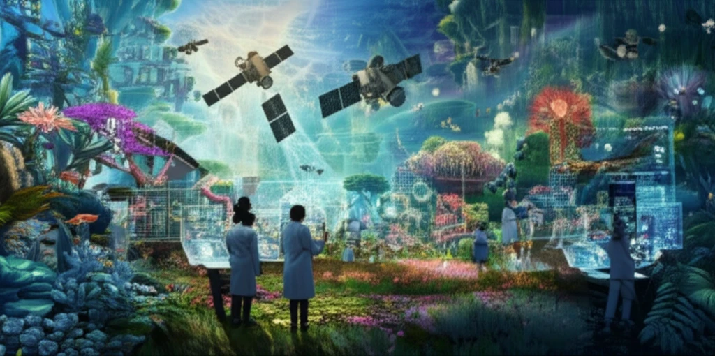
A digital illustration depicting the use of AI and satellite imagery for environmental conservation. The image shows a vibrant ecosystem with diverse plants and wildlife, being monitored by a network of orbiting satellites. Scientists collaborate to analyze the data. The image uses a bright, hopeful color palette to convey optimism about the future of environmental conservation.

Mapping the Future: How AI and Satellite Imagery Are Revolutionizing Environmental Conservation

"From the Tunisian Desert to the World: Unveiling the Power of AI and Remote Sensing in Preserving Our Planet's Delicate Ecosystems"


In an era defined by rapid environmental change, the need for effective conservation strategies has never been more critical. Our planet's precious ecosystems face unprecedented threats from climate change, habitat loss, and human activities. But amidst these challenges, a wave of innovation is emerging, offering new tools and approaches to protect our natural world. At the forefront of this revolution are artificial intelligence (AI) and remote sensing technologies, particularly satellite imagery. These powerful tools are changing the game for environmental conservation, providing scientists and conservationists with unprecedented insights into our planet's health.

The research, "Decision tree for mapping of halophyte cover around Ghannouch, Tunisia," published in the journal Environmental Monitoring and Assessment, provides a compelling case study of how these technologies are applied in the field. This study focuses on the Ghannouch region of Tunisia, an area characterized by unique ecosystems and threatened by environmental challenges. This article delves into the methodology used in the research, its significant findings, and the broader implications for global environmental conservation. We'll explore how AI and satellite imagery are providing scientists and conservationists with an ability to monitor ecosystems and make more informed decisions.

The implications of this research extend far beyond Tunisia. The methodologies and insights gained from this study are applicable to a wide range of ecosystems around the world. By leveraging the power of AI and satellite imagery, we can better understand the threats facing these areas and take effective action to protect them. This article will equip you with knowledge to appreciate the incredible potential of these technologies and inspire you to learn more about their impact on the world.

Unveiling the Secrets of Ghannouch: A Case Study in Halophyte Mapping

A digital illustration depicting the use of AI and satellite imagery for environmental conservation. The image shows a vibrant ecosystem with diverse plants and wildlife, being monitored by a network of orbiting satellites. Scientists collaborate to analyze the data. The image uses a bright, hopeful color palette to convey optimism about the future of environmental conservation.

The study focuses on the Ghannouch region in Tunisia, a unique environment where hypersaline soils are home to halophytes—plants that thrive in salty conditions. These areas are vital for biodiversity and play a crucial role in the ecosystem's health. However, like many ecosystems, they face threats from human activities and environmental changes. The research team's objective was to map the distribution of halophytes in the area. This information is essential for understanding the extent of salinization and its impact on the environment, paving the way for effective conservation strategies.

The researchers used a decision tree approach, a type of AI algorithm, to analyze data from the European Space Agency's Sentinel-2 satellite. Sentinel-2 captures images in several bands of the electromagnetic spectrum, from visible light to near-infrared. By analyzing this data, the AI algorithm was able to identify and map the halophytes. This process involved several steps, including:

  • Data Preprocessing: Preparing the satellite imagery for analysis using specialized software tools.
  • Feature Extraction: Calculating spectral indices, such as the Normalized Difference Vegetation Index (NDVI) and salinity indices, to highlight specific features in the landscape.
  • Decision Tree Creation: Building an AI model that uses the spectral information to classify land cover types, including halophytes.
  • Validation: Comparing the AI model's classifications to ground-truth data to ensure accuracy.
The results of this research are truly impressive. The study found that at least 68% of the area was classified as halophyte land cover. This represents a significant accomplishment. The successful mapping of halophytes in Ghannouch is a crucial step toward effective environmental management. It offers the potential to monitor changes over time and provide valuable insights into the impacts of climate change and human activities. Furthermore, the methods and results of the research have broad applications. The study provides a model for monitoring and protecting similar ecosystems in other parts of the world.

A Brighter Future for Our Planet

The integration of AI and remote sensing technologies represents a paradigm shift in environmental conservation. The successful mapping of halophytes in Ghannouch, Tunisia, is a testament to the potential of these tools. It is a reminder that, even in the face of complex environmental challenges, human ingenuity and innovative technology can make a profound difference. These advancements offer a reason to be optimistic about the future of environmental conservation. By continuing to invest in research, embrace new technologies, and work together, we can create a more sustainable world for all.

About this Article -

This article was crafted using a human-AI hybrid and collaborative approach. AI assisted our team with initial drafting, research insights, identifying key questions, and image generation. Our human editors guided topic selection, defined the angle, structured the content, ensured factual accuracy and relevance, refined the tone, and conducted thorough editing to deliver helpful, high-quality information.See our About page for more information.

This article is based on research published under:

DOI-LINK: 10.1007/s10661-018-7115-3, Alternate LINK

Title: Decision Tree For Mapping Of Halophyte Cover Around Ghannouch, Tunisia

Subject: Management, Monitoring, Policy and Law

Journal: Environmental Monitoring and Assessment

Publisher: Springer Science and Business Media LLC

Authors: Rim Attya Bouchhima, Maurizio Sarti, Marco Ciolfi, Marco Lauteri, Mohamed Ksibi

Published: 2018-11-22

Everything You Need To Know

1

How is artificial intelligence (AI) being used in environmental conservation, according to the information available?

Artificial intelligence, specifically a decision tree approach, is used to analyze satellite imagery, such as that from the European Space Agency's Sentinel-2 satellite. By analyzing data from various bands of the electromagnetic spectrum, the AI algorithm can identify and map specific features in the landscape. This is exemplified by the mapping of halophytes in the Ghannouch region of Tunisia, enabling scientists to monitor changes over time and understand the impacts of climate change and human activities. AI facilitates informed decisions for effective environmental management and conservation strategies. Without AI the processing would take much longer and be less accurate.

2

What is the significance of mapping halophytes, as demonstrated in the Ghannouch region of Tunisia?

Mapping halophytes in the Ghannouch region is crucial for understanding the extent of salinization and its impact on the environment. Halophytes are plants that thrive in salty conditions, and their distribution is essential for biodiversity and ecosystem health. The mapping provides a baseline for monitoring changes over time, offering valuable insights into the impacts of climate change and human activities. The success of the halophyte mapping serves as a model for monitoring and protecting similar ecosystems globally.

3

What role does remote sensing, particularly satellite imagery, play in revolutionizing environmental conservation efforts?

Remote sensing, especially through satellite imagery like that from Sentinel-2, provides scientists and conservationists with unprecedented insights into our planet's health. Satellite imagery captures data in several bands of the electromagnetic spectrum, allowing for the calculation of spectral indices, such as the Normalized Difference Vegetation Index (NDVI) and salinity indices, to highlight specific features in the landscape. This enables the monitoring of ecosystems, the mapping of vegetation cover, and the assessment of environmental changes over large areas, facilitating more informed conservation decisions. The Tunisian study employed Sentinel-2. Remote sensing allows us to see environmental changes over large areas.

4

Can you explain the decision tree methodology used in the 'Decision tree for mapping of halophyte cover around Ghannouch, Tunisia' research?

The decision tree methodology used in the Ghannouch study involves several steps to analyze satellite imagery and map halophytes. First, the satellite imagery undergoes data preprocessing using specialized software tools. Then, spectral indices like NDVI and salinity indices are extracted to highlight specific landscape features. A decision tree, an AI model, is created to classify land cover types based on spectral information, specifically to identify halophytes. Finally, the AI model's classifications are validated by comparing them to ground-truth data to ensure accuracy. The application of the decision tree methodology led to the successful mapping of halophytes in the area, enabling effective monitoring of ecosystems.

5

What are the broader implications of integrating AI and satellite imagery for global environmental conservation beyond the Ghannouch study?

The integration of AI and satellite imagery has far-reaching implications for environmental conservation worldwide. The methodologies and insights from the Ghannouch study are applicable to various ecosystems facing threats from climate change, habitat loss, and human activities. By leveraging these technologies, scientists and conservationists can better monitor ecosystems, understand threats, and make informed decisions for effective action. The successful mapping of halophytes in Ghannouch is a testament to the potential of these tools, fostering optimism about the future of environmental conservation. Continued investment in research and adoption of these technologies can lead to a more sustainable world. These could also be combined with drones and other technologies to provide multiple points of views.

Newsletter Subscribe

Subscribe to get the latest articles and insights directly in your inbox.