Satellite view of a coastline with spectral analysis data highlighting water turbidity.

Unlocking Shoreline Secrets: How Spectral Analysis is Rewriting Coastal Mapping

"Discover how innovative spectral analysis techniques are enhancing the accuracy of shoreline mapping, offering new insights for environmental management and coastal preservation with soft classification."


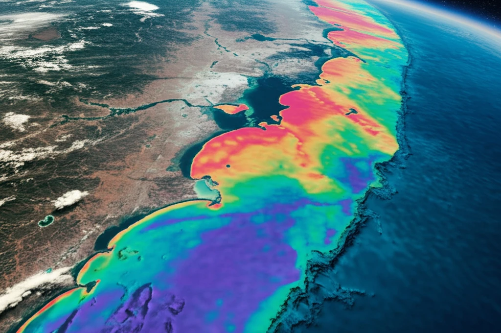
Shoreline mapping, traditionally reliant on conventional image classification, faces significant hurdles due to mixed pixels—those ambiguous areas in satellite images that blur the lines between land and water. These mixed pixels, abundant in remotely sensed imagery, can undermine the accuracy of coastal maps, complicating efforts in environmental management and preservation. The limitations of hard classification, which assigns each pixel to a single land cover class, fail to capture the nuanced reality of coastal zones where land and water intertwine.

To address these challenges, scientists are turning to soft or fuzzy classification techniques. These methods allow for partial- and multiple-class membership within each mixed pixel, offering a more refined approach to mapping. By acknowledging the gradations and blends within coastal environments, soft classification enhances the precision of land cover mapping derived from remote sensing. This improved accuracy is crucial for effective coastal management and informed decision-making.

One promising avenue for refining shoreline mapping lies in super-resolution mapping (SRM). SRM techniques predict the location of land cover classes within each image pixel by using fraction images derived from soft classification. By delineating a pixel into a matrix of sub-pixels, SRM enhances the spatial resolution of coastal maps, providing a more detailed and accurate representation of shoreline boundaries. This advancement holds the potential to transform how we monitor and manage our coastlines.

The Power of Spectral Analysis in Coastal Mapping

Satellite view of a coastline with spectral analysis data highlighting water turbidity.

At the heart of this revolution is spectral analysis, a method that examines the interaction of electromagnetic radiation with different materials. Each substance reflects, absorbs, and emits energy in a unique way, creating a spectral signature that can be detected by remote sensors. However, intra-class spectral variability—the range of spectral signatures within a single land cover class—presents a considerable challenge. Factors such as water turbidity, vegetation density, and soil composition can alter spectral responses, complicating accurate classification.

To mitigate the impacts of intra-class spectral variation, researchers are exploring the use of spectral sub-classes. Rather than treating water as a single entity, for example, they differentiate between clear water and turbid water, each with its distinct spectral signature. This approach acknowledges the heterogeneity within broad land cover classes, enhancing the accuracy of soft classification and super-resolution mapping.

  • Enhances the precision of land cover mapping.
  • Improves the accuracy of soft classification.
  • Addresses intra-class spectral variation.
  • Facilitates better coastal zone management.
Consider the study area on the Isle of Wight, UK, where significant intra-class spectral variation exists due to varying water turbidity. By dividing the water class into two spectral sub-classes—turbid water and clear water—scientists were able to improve the accuracy of shoreline mapping. The study utilized a linear mixture model (LMM) to estimate fractional compositions from multispectral images, combined with contouring and Hopfield neural network (HNN) methods for super-resolution mapping. Results indicated that reducing intra-class spectral variation increased the correlation between predicted and actual class coverage, enhancing the overall accuracy of shoreline mapping.

The Future of Coastal Mapping

The integration of spectral analysis techniques, particularly the use of spectral sub-classes, represents a significant step forward in shoreline mapping. By reducing the impacts of intra-class spectral variation, scientists can achieve more accurate and reliable coastal maps, crucial for effective environmental management. As remote sensing technologies continue to advance, the potential for even more precise and detailed coastal monitoring is within reach. These advancements promise to provide valuable insights for coastal preservation, urban planning, and climate resilience.

About this Article -

This article was crafted using a human-AI hybrid and collaborative approach. AI assisted our team with initial drafting, research insights, identifying key questions, and image generation. Our human editors guided topic selection, defined the angle, structured the content, ensured factual accuracy and relevance, refined the tone, and conducted thorough editing to deliver helpful, high-quality information.See our About page for more information.

This article is based on research published under:

DOI-LINK: 10.1080/01431161.2018.1545099, Alternate LINK

Title: Reducing The Impacts Of Intra-Class Spectral Variability On The Accuracy Of Soft Classification And Super-Resolution Mapping Of Shoreline

Subject: General Earth and Planetary Sciences

Journal: International Journal of Remote Sensing

Publisher: Informa UK Limited

Authors: Huong T. X. Doan, Giles M. Foody, Dieu Tien Bui

Published: 2018-11-13

Everything You Need To Know

1

What are the main limitations of traditional shoreline mapping techniques when dealing with coastal environments?

Traditional shoreline mapping struggles with correctly classifying "mixed pixels", which contain a blend of land and water. Hard classification assigns each pixel to a single category, but this fails to capture the complexities of coastal zones. This leads to inaccuracies that can hinder coastal management and preservation efforts.

2

How does soft classification improve the accuracy of shoreline mapping compared to traditional hard classification methods?

"Soft classification" addresses the challenges of mixed pixels by allowing pixels to belong to multiple classes simultaneously, acknowledging the gradations between land and water. This is a more refined approach compared to hard classification, enhancing the precision of land cover mapping derived from remote sensing.

3

What is super-resolution mapping (SRM) and how does it refine the representation of shoreline boundaries?

"Super-resolution mapping (SRM)" enhances the spatial resolution of coastal maps. It predicts the location of land cover classes within each image pixel by using fraction images derived from soft classification, essentially breaking down each pixel into smaller sub-pixels for more detailed mapping of shoreline boundaries. Methods such as contouring and Hopfield neural network (HNN) can be used within the SRM framework.

4

What is intra-class spectral variation, and why does it pose a challenge for accurate shoreline mapping?

"Intra-class spectral variation" refers to the range of spectral signatures within a single land cover class, caused by factors like water turbidity or vegetation density. This variation complicates accurate classification because the same type of surface can have different spectral responses, making it harder for remote sensors to correctly identify it. Spectral sub-classes are used to further categorize a class by differentiating water into, for example, clear water and turbid water, each with its distinct spectral signature.

5

How do spectral sub-classes help in improving the accuracy of coastal mapping, especially when dealing with intra-class spectral variation?

Researchers are exploring the use of "spectral sub-classes" to mitigate the impacts of intra-class spectral variation. By dividing broad land cover classes into more specific categories based on their unique spectral signatures—for example, differentiating between clear and turbid water—scientists enhance the accuracy of soft classification and super-resolution mapping, leading to more precise coastal maps. A linear mixture model (LMM) can be used to estimate fractional compositions from multispectral images.

Newsletter Subscribe

Subscribe to get the latest articles and insights directly in your inbox.