Satellite view of Earth's forests, illustrating deforestation monitoring with radar technology.

Unlocking Earth's Secrets: How Satellite Data is Revolutionizing Forest Conservation

"Discover how the TanDEM-X mission's innovative mapping is transforming our ability to monitor deforestation and safeguard our planet's vital ecosystems."


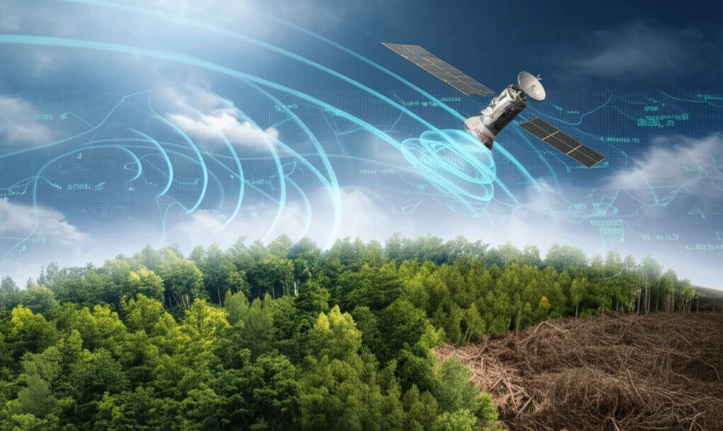
Forests are the lungs of our planet, playing a crucial role in regulating the climate, maintaining biodiversity, and supporting countless ecosystems. However, these vital resources are under constant threat from deforestation, driven by both natural disasters and human activities. Monitoring these changes effectively is essential for conservation efforts and sustainable resource management.

Traditional methods of forest monitoring can be time-consuming, expensive, and limited in scope. Satellite technology, particularly Synthetic Aperture Radar (SAR) missions like TanDEM-X, offers a powerful alternative. These missions can collect data on a global scale, regardless of weather conditions or time of day, providing invaluable insights into forest health and dynamics.

This article explores the potential of TanDEM-X data for revolutionizing forest conservation. We will delve into how this innovative technology is being used to detect deforestation, assess forest degradation, and support global initiatives like REDD+ (Reducing Emissions from Deforestation and Forest Degradation).

Mapping the World's Forests: The TanDEM-X Advantage

Satellite view of Earth's forests, illustrating deforestation monitoring with radar technology.

The German Aerospace Center's (DLR) TanDEM-X mission has generated a global Digital Elevation Model (DEM) with impressive 12 m x 12 m resolution. From this dataset, a global Forest/Non-Forest (FNF) Map has been created, mosaicking over 500,000 quick-look images at a 50 m x 50 m resolution. This vast amount of data opens up new possibilities for monitoring forest changes over time.

What makes TanDEM-X so effective? Its unique ability to acquire single-pass interferometric data allows for detailed mapping of forest structures. This is particularly important because forests are complex, three-dimensional environments where traditional optical sensors often struggle to penetrate the canopy.

  • Global Coverage: TanDEM-X provides consistent data across the entire globe, enabling comprehensive monitoring efforts.
  • High Resolution: The 12m resolution DEM allows for detailed analysis of forest structure and changes.
  • All-Weather Capability: SAR technology can penetrate clouds and operate day or night, ensuring continuous data acquisition.
  • Historical Data: Multiple TanDEM-X global coverages between 2011 and 2016 enable the detection of changes over time.
The TanDEM-X FNF map distinguishes between forest and non-forest areas based on the volume correlation factor, a measure of decorrelation due to volume scattering. This factor is highly sensitive to the presence of vegetation, making it an effective tool for identifying forested regions. The TanDEM-X binary FNF map, along with associated data layers, is freely available for scientific purposes, fostering collaboration and innovation in forest conservation.

The Future of Forest Monitoring: High-Resolution Insights

TanDEM-X high-resolution images offer even greater potential for forest monitoring. By acquiring time series data over specific regions, it's possible to measure important parameters like deforestation rates and the extent of forest degradation. This information is critical for detecting illegal logging, assessing the impact of natural disasters, and guiding sustainable forestry practices. The combination of TanDEM-X DEM and FNF data provides a powerful tool for understanding and protecting our planet's forests.

About this Article -

This article was crafted using a human-AI hybrid and collaborative approach. AI assisted our team with initial drafting, research insights, identifying key questions, and image generation. Our human editors guided topic selection, defined the angle, structured the content, ensured factual accuracy and relevance, refined the tone, and conducted thorough editing to deliver helpful, high-quality information.See our About page for more information.

This article is based on research published under:

DOI-LINK: 10.1109/igarss.2018.8517867, Alternate LINK

Title: Potentials Of Tandem-X Forest/Non-Forest Map For Change Detection

Journal: IGARSS 2018 - 2018 IEEE International Geoscience and Remote Sensing Symposium

Publisher: IEEE

Authors: Jose Luis Bueso Bello, Paola Rizzoli, Michele Martone, Carolina Gonzalez

Published: 2018-07-01

Everything You Need To Know

1

What makes the TanDEM-X mission so effective in mapping and monitoring forests compared to traditional methods?

The TanDEM-X mission is particularly effective due to its unique capability to acquire single-pass interferometric data. This allows for detailed mapping of forest structures, which is crucial because forests are complex, three-dimensional environments where traditional optical sensors often struggle to penetrate the canopy. The mission provides global coverage, high resolution data (12m DEM), all-weather capability, and historical data enabling change detection over time.

2

How does the TanDEM-X Forest/Non-Forest map differentiate between forested and non-forested areas?

The TanDEM-X Forest/Non-Forest (FNF) map distinguishes between forest and non-forest areas based on the volume correlation factor. This factor measures decorrelation due to volume scattering and is highly sensitive to the presence of vegetation, making it an effective tool for identifying forested regions. It leverages Synthetic Aperture Radar (SAR) technology.

3

How is data from the TanDEM-X mission relevant to global initiatives like REDD+ (Reducing Emissions from Deforestation and Forest Degradation)?

The TanDEM-X mission is relevant to REDD+ because it provides crucial data for monitoring deforestation and forest degradation, which are key components of the REDD+ initiative. The high-resolution data helps in accurately assessing changes in forest cover and biomass, essential for the effective implementation and monitoring of REDD+ projects.

4

Does the TanDEM-X mission directly measure biodiversity within forests, or are there other methods needed to assess this aspect of forest health?

While TanDEM-X offers valuable insights into forest structure and changes through its Digital Elevation Model (DEM) and Forest/Non-Forest (FNF) map, it doesn't directly measure biodiversity. Assessing biodiversity typically requires on-the-ground surveys and other remote sensing techniques that capture different aspects of ecosystem health, like species distribution and habitat quality. However, TanDEM-X data can be used in conjunction with other datasets to infer potential biodiversity hotspots based on forest structure and fragmentation.

5

What are the potential advancements and implications for the future of forest monitoring using TanDEM-X high-resolution images?

The future of forest monitoring using TanDEM-X high-resolution images involves leveraging time-series data to measure deforestation rates and the extent of forest degradation. This data is critical for detecting illegal logging, assessing the impact of natural disasters, and guiding sustainable forestry practices. Combining TanDEM-X DEM and FNF data provides a powerful tool for understanding and protecting our planet's forests, potentially enhancing global conservation efforts.

Newsletter Subscribe

Subscribe to get the latest articles and insights directly in your inbox.