Underwater scene showing interpolation of bathymetric data

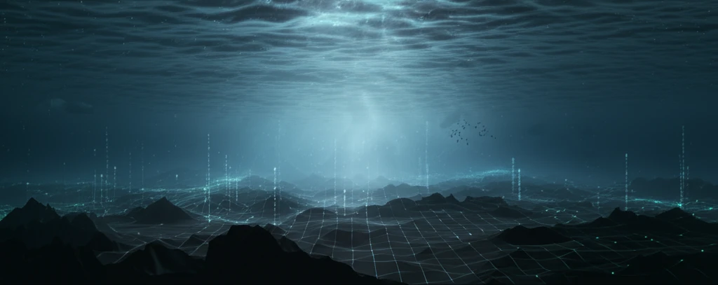
Unlock the Secrets of Submerged Landscapes: Choosing the Right Interpolation Technique

"IDW vs. Kriging: A Comprehensive Guide to Mapping Bathymetric Surfaces for Accurate Underwater Modeling"


Understanding the topography beneath the water's surface is crucial for a wide range of applications, from coastal management and infrastructure development to environmental monitoring and resource exploration. Bathymetric surveys provide the raw data, but turning that data into a usable model requires sophisticated interpolation techniques. These techniques estimate the depth at locations where no direct measurements were taken, creating a continuous surface that represents the underwater terrain.

Choosing the right interpolation method is paramount. The accuracy and reliability of your underwater models depend heavily on this choice. Different methods have their own strengths and weaknesses, and the best option will vary depending on the characteristics of your data and the specific goals of your project.

This article dives into a comparison of two popular interpolation methods: Inverse Distance Weighted (IDW) and Kriging. We'll explore how they work, their advantages and disadvantages, and provide guidance on when to use each technique to create the most accurate bathymetric surface.

IDW and Kriging: What's the Difference?

Underwater scene showing interpolation of bathymetric data

Both Inverse Distance Weighted (IDW) and Kriging are used to estimate values at unsampled locations based on the values of nearby sampled points. However, they differ significantly in their approach.

IDW is a deterministic method, meaning it relies solely on mathematical formulas to calculate the estimated values. The basic principle of IDW is that points closer to the unsampled location have a greater influence on the estimated value than points farther away. The influence is weighted by the inverse of the distance raised to a power.

  • Simplicity: IDW is easy to understand and implement.
  • Speed: It's computationally fast, making it suitable for large datasets.
  • Limited Accuracy: IDW doesn't account for the spatial autocorrelation in the data, which can lead to inaccuracies.
  • Sensitivity to Outliers: Outliers can have a significant impact on the interpolated surface.
Kriging, on the other hand, is a geostatistical method that takes into account the spatial autocorrelation of the data. It uses a semivariogram to model the spatial variability and then uses this model to estimate the weights assigned to each sampled point. Kriging aims to provide the best linear unbiased estimate, meaning it minimizes the variance of the estimation errors.

Making the Right Choice

The choice between IDW and Kriging depends on the specific requirements of your project. If speed and simplicity are paramount, and you have a dense and relatively clean dataset, IDW may be sufficient. However, if accuracy is critical, and you need to account for spatial autocorrelation and minimize estimation errors, Kriging is the superior choice. Remember to always validate your results using cross-validation techniques to ensure the reliability of your interpolated surface.

About this Article -

This article was crafted using a human-AI hybrid and collaborative approach. AI assisted our team with initial drafting, research insights, identifying key questions, and image generation. Our human editors guided topic selection, defined the angle, structured the content, ensured factual accuracy and relevance, refined the tone, and conducted thorough editing to deliver helpful, high-quality information.See our About page for more information.

This article is based on research published under:

DOI-LINK: 10.1590/s1982-21702017000300033, Alternate LINK

Title: In Bathymetric Surfaces: Idw Or Kriging?

Subject: General Earth and Planetary Sciences

Journal: Boletim de Ciências Geodésicas

Publisher: FapUNIFESP (SciELO)

Authors: Italo Oliveira Ferreira, Dalto Domingos Rodrigues, Gérson Rodrigues Dos Santos, Lidiane Maria Ferraz Rosa

Published: 2017-09-01

Everything You Need To Know

1

What distinguishes Inverse Distance Weighted (IDW) from Kriging in the context of interpolating bathymetric surfaces?

Inverse Distance Weighted (IDW) is a deterministic interpolation method that estimates values at unsampled locations based on the values of nearby sampled points. It operates on the principle that points closer to the unsampled location have a greater influence on the estimated value, weighted by the inverse of the distance raised to a power. Kriging, however, is a geostatistical method that accounts for the spatial autocorrelation of the data by using a semivariogram to model spatial variability and estimate weights for sampled points, aiming to provide the best linear unbiased estimate.

2

What are the advantages and disadvantages of using Inverse Distance Weighted (IDW) for bathymetric interpolation, and when might Kriging be a better choice?

The primary advantage of using Inverse Distance Weighted (IDW) is its simplicity and computational speed, making it suitable for large datasets where quick results are needed. However, IDW's limitations include its failure to account for spatial autocorrelation, which can lead to inaccuracies, and its sensitivity to outliers, which can significantly impact the interpolated surface. Kriging, on the other hand, is more complex but provides better accuracy by considering spatial autocorrelation and minimizing estimation errors.

3

Under what circumstances would you recommend using Inverse Distance Weighted (IDW) over Kriging for creating a bathymetric surface model?

When speed and simplicity are most important, and the dataset is dense and relatively free of errors, Inverse Distance Weighted (IDW) can be a suitable choice for bathymetric surface interpolation. However, if accuracy is critical, and the project requires accounting for spatial autocorrelation and minimizing estimation errors, Kriging is generally the better option. The best choice depends on the specific requirements, available resources, and acceptable levels of error for the project.

4

What does 'spatial autocorrelation' mean, particularly in the context of bathymetric data, and how does Kriging use this concept?

Spatial autocorrelation, as used in Kriging, refers to the correlation of a variable with itself through space. In the context of bathymetric data, spatial autocorrelation means that data points that are closer together are more likely to have similar depth values than points that are farther apart. Kriging uses this concept to model the spatial variability of the bathymetric surface using a semivariogram, which helps in estimating the weights assigned to each sampled point for interpolation. Inverse Distance Weighted (IDW) does not account for spatial autocorrelation.

5

Why is cross-validation essential when using either Inverse Distance Weighted (IDW) or Kriging to create an interpolated bathymetric surface, and what does it help to achieve?

Cross-validation is crucial to ensure the reliability of an interpolated bathymetric surface. This involves removing some of the known data points and then using either Inverse Distance Weighted (IDW) or Kriging to predict the values at those locations. By comparing the predicted values with the actual measured values, the accuracy and reliability of the interpolation method can be assessed. This process helps to identify potential errors and validate the suitability of the chosen method for creating a reliable bathymetric surface model.

Newsletter Subscribe

Subscribe to get the latest articles and insights directly in your inbox.