Decoding Salinity: How Satellite Mapping Can Save Tunisia's Landscapes
"Uncover how a groundbreaking mapping technique is helping Tunisia combat soil salinity, ensuring sustainable agriculture and environmental preservation."
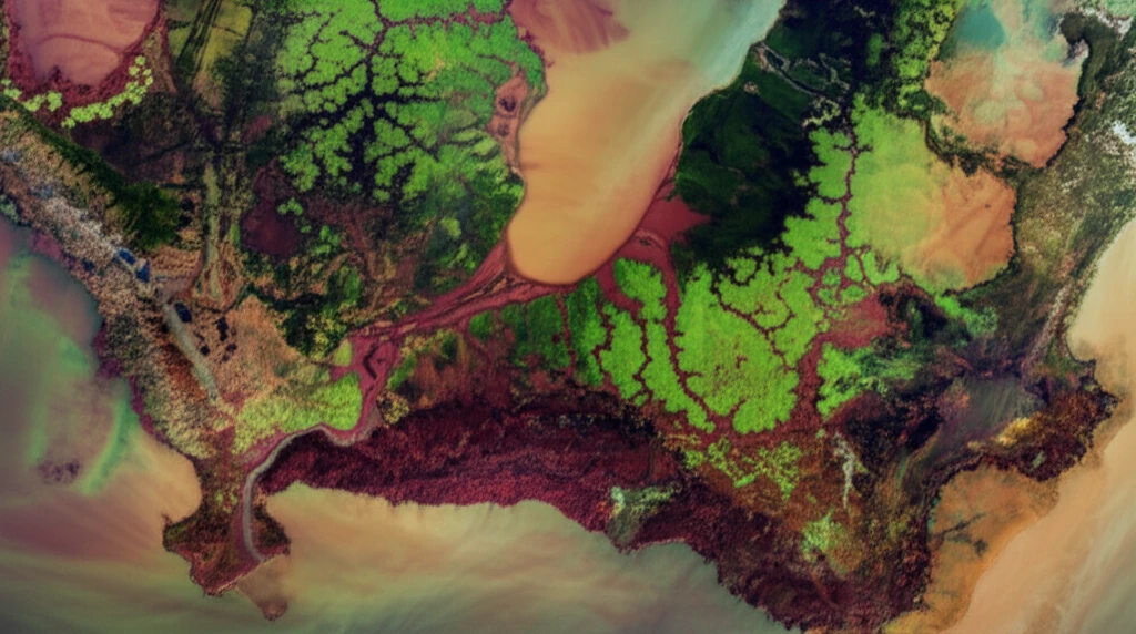
The environment around Ghannouch, in southeastern Tunisia, faces a significant challenge: widespread hypersaline soils. These soils, characterized by high salt content, are often colonized by halophytes, salt-tolerant plants. Understanding the distribution of these plants is crucial for assessing the extent and dynamics of salinization, which threatens agricultural productivity and ecosystem health.
Traditional methods of monitoring soil salinity are often time-consuming and limited in scope. However, remote sensing technology offers a powerful alternative. By analyzing optical data from satellites, researchers can efficiently map and monitor halophyte vegetation over large areas, providing valuable insights into the spatial and temporal dimensions of salinization.
In a recent study, scientists have developed a novel approach using a decision tree algorithm applied to imagery from the European Space Agency's Sentinel-2 satellite. This method enables accurate land cover mapping in the Ghannouch district, offering a promising tool for combating soil salinity and promoting sustainable land management practices.
Mapping Halophytes with Satellite Imagery: A Technological Breakthrough
The innovative mapping approach leverages the spectral information captured by Sentinel-2 across various channels of the visible-near-infrared spectrum. By combining this spectral data with several optical indices, including the Normalized Difference Water Index (NDWI), Normalized Difference Vegetation Index (NDVI), and various soil salinity indices (SIs), researchers were able to create a robust decision tree algorithm.
- NDWI for Water Detection: The Normalized Difference Water Index (NDWI) is used to identify water bodies, which are excluded from areas likely to host halophytes.
- NDVI for Vegetation Assessment: The Normalized Difference Vegetation Index (NDVI) helps in assessing vegetation density and intensity, distinguishing between dense vegetation, sparse vegetation, and bare soil.
- Soil Salinity Indices (SIs): Various soil salinity indices are employed to detect salt-affected soils, which are indicative of potential halophyte habitats.
- ANDVI for Change Detection: The absolute NDVI difference (|ANDVI|) between two acquisition dates helps identify areas with significant vegetation changes, further refining the halophyte mapping process.
Future Implications and Global Applications
This study's success paves the way for broader applications in environmental monitoring and sustainable land management. By accurately mapping halophyte vegetation, researchers and policymakers can better understand the dynamics of soil salinity and implement targeted interventions to mitigate its impact. This approach can be particularly valuable in regions facing similar environmental challenges, offering a scalable and cost-effective solution for monitoring and managing soil salinity on a global scale.