Surreal illustration of melting glaciers and Santiago cityscape, representing Chile's water crisis.

Melting Point: How Climate Change is Reshaping Chile's Water Future

"A deep dive into the Rio Maipo basin, revealing the stark realities of hydrological shifts and glacier loss threatening Santiago's water security."


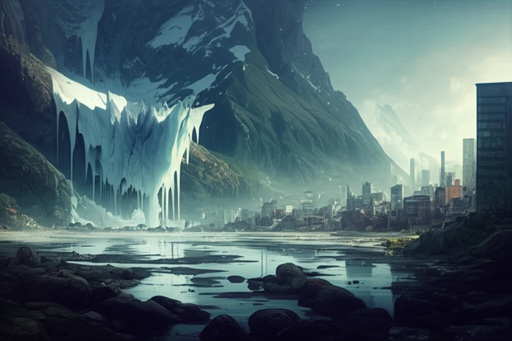
Water security is a growing concern worldwide, and the Andean region is particularly vulnerable. As temperatures rise and demographic pressures increase, the delicate balance of water resources is being disrupted, leading to shrinking glaciers and altered river flows. Central Chile, a semi-arid region heavily reliant on summer meltwater, faces a precarious future.

The Maipo River, the lifeblood of the Santiago metropolitan area, is at the heart of this crisis. Supplying 70-90% of the water for Santiago's 7 million+ residents and crucial for agriculture, the river's hydrological cycle is undergoing a dramatic transformation. Understanding these changes is critical for policymakers and communities dependent on this vital resource.

This article delves into a recent study published in Climate journal, which uses advanced hydrological modeling to project the future of the Rio Maipo basin under various climate change scenarios. We'll explore the key findings, potential impacts, and what it all means for the future water security of central Chile.

Modeling the Future: A Look at the Poly-Hydro Model

Surreal illustration of melting glaciers and Santiago cityscape, representing Chile's water crisis.

To understand the complex interplay of factors affecting the Maipo River, researchers employed the Poly-Hydro model. This sophisticated tool simulates the key hydrological components of the basin, including snow and ice melt, river flow, and glacier dynamics. By inputting historical climate data, field measurements, and projections from global climate models, the Poly-Hydro model can forecast how the river system will respond to future climate change.

The model incorporates a range of data, including:

  • Ice ablation and thickness measurements gathered from field studies.
  • Weather and hydrological data from stations within the Maipo basin.
  • Snow cover and temperature information derived from MODIS satellite imagery.
  • Precipitation data from the Tropical Rainfall Measurement Mission (TRMM).
  • Future weather projections from three different Global Climate Models (GCMs) under various Representative Concentration Pathways (RCPs). These RCPs (2.6, 4.5, and 8.5) represent different scenarios for future greenhouse gas emissions and radiative forcing.
By analyzing the model's output under these different scenarios, scientists can gain valuable insights into the potential range of future conditions and the likely impacts on water availability.

A Call to Action: Adapting to a Changing Water Landscape

The future of water resources in central Chile is undeniably linked to climate change. The study's projections paint a clear picture: glacier loss will accelerate, rainfall patterns will shift, and water availability in the Maipo River will likely decline. Policymakers and communities must proactively adapt to these changing conditions through sustainable water management practices, investments in water infrastructure, and strategies to mitigate the impacts of climate change. The time to act is now, to ensure a secure water future for Santiago and the surrounding region.

About this Article -

This article was crafted using a human-AI hybrid and collaborative approach. AI assisted our team with initial drafting, research insights, identifying key questions, and image generation. Our human editors guided topic selection, defined the angle, structured the content, ensured factual accuracy and relevance, refined the tone, and conducted thorough editing to deliver helpful, high-quality information.See our About page for more information.

This article is based on research published under:

DOI-LINK: 10.3390/cli6030057, Alternate LINK

Title: Modelling Hydrological Components Of The Rio Maipo Of Chile, And Their Prospective Evolution Under Climate Change

Subject: Atmospheric Science

Journal: Climate

Publisher: MDPI AG

Authors: Daniele Bocchiola, Andrea Soncini, Antonella Senese, Guglielmina Diolaiuti

Published: 2018-06-25

Everything You Need To Know

1

Why is the Rio Maipo basin so important to central Chile, and how is climate change impacting it?

The Rio Maipo basin is vital because the Maipo River supplies 70-90% of the water for Santiago's residents and is crucial for agriculture in central Chile. Climate change threatens this supply by melting glaciers and altering rainfall patterns, endangering the water security for over 7 million people.

2

What is the Poly-Hydro model, and how does it help in understanding the future of the Maipo River?

The Poly-Hydro model is a sophisticated tool used to simulate hydrological components in the Maipo River basin, including snow and ice melt, river flow, and glacier dynamics. It forecasts the river system's response to climate change by integrating historical climate data, field measurements, and projections from Global Climate Models, providing insights into future water availability. Its sophistication lies in combining multiple data sources.

3

What role do Global Climate Models (GCMs) and Representative Concentration Pathways (RCPs) play in projecting water availability in the Maipo River basin?

Global Climate Models (GCMs) provide future weather projections under different Representative Concentration Pathways (RCPs), such as 2.6, 4.5, and 8.5. These RCPs represent different scenarios for future greenhouse gas emissions and radiative forcing. By using various RCPs, the Poly-Hydro model can project a range of potential future conditions and their impacts on water availability in the Maipo River basin.

4

What are the projected impacts of climate change on water resources in central Chile, and what actions are needed to address them?

The study's projections show that glacier loss will accelerate, rainfall patterns will shift, and water availability in the Maipo River is likely to decline. These changes necessitate sustainable water management practices, investments in water infrastructure, and strategies to mitigate climate change impacts to ensure a secure water future for Santiago and the surrounding region. If no action is taken Santiago will be in water crisis.

5

How does data from the Tropical Rainfall Measurement Mission (TRMM) contribute to the understanding of water resources in the Maipo River basin?

The Tropical Rainfall Measurement Mission (TRMM) provides crucial precipitation data for the Maipo River basin, which is integrated into the Poly-Hydro model. Accurate precipitation data is essential for simulating river flow and understanding the hydrological cycle. While TRMM provides rainfall data, it is also important to note that snow cover and temperature information derived from MODIS satellite imagery are also used to develop a more full understanding of water flow in the area.

Newsletter Subscribe

Subscribe to get the latest articles and insights directly in your inbox.