Seismic waves revealing subsurface layers and resource deposits.

Delving Deep: How Seismic Surveys Uncover Hidden Resources

"Unlocking Earth's Secrets: A look at seismic reflection surveys for resource exploration in Bishop Wood, Yorkshire."


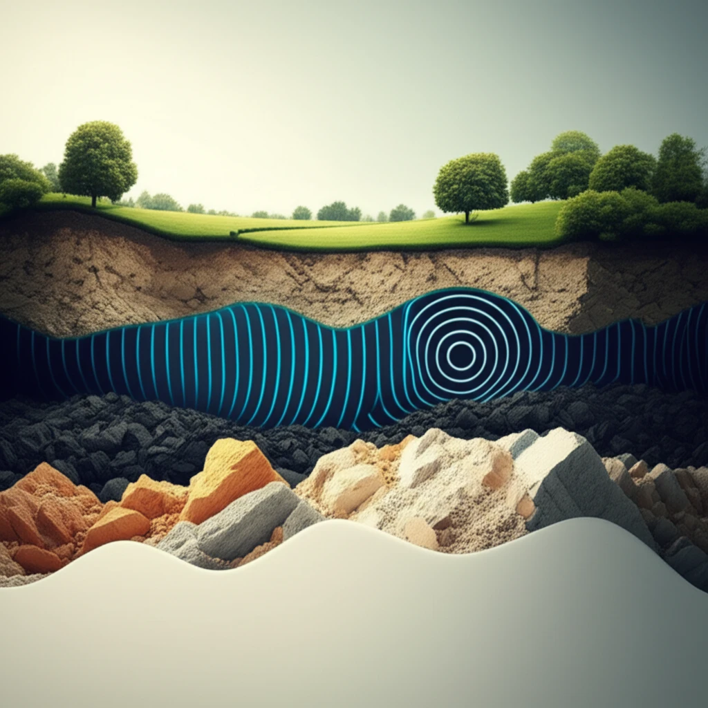
Imagine trying to understand what's beneath your feet without digging a single hole. That's essentially what geophysicists do with seismic reflection surveys. These techniques use sound waves to create images of the Earth's subsurface, helping us find valuable resources and understand geological structures.

Seismic reflection surveys have been a game-changer in resource exploration since the 1930s. Initially focused on hydrocarbon exploration, the technology has evolved significantly thanks to advancements in electronics and computing. The method works by processing raw data to produce seismic sections, which are essentially images of the subsurface. However, interpreting these images requires a solid understanding of how the data was acquired and processed.

A seismic reflection survey was conducted in Bishop Wood, Yorkshire, to map subsurface structures and assess the depth of gypsum and coal deposits. This article will explore the methodologies employed, the findings obtained, and how they correlate with existing borehole data.

Mapping the Underground: How Seismic Surveys Work

Seismic waves revealing subsurface layers and resource deposits.

The seismic survey in Bishop Wood used a controlled source of energy, in this case an accelerated weight drop (PEG40), to generate seismic waves. These waves travel into the earth and are reflected back to the surface by different rock layers. Receivers called geophones, planted at regular intervals, record the returning waves. The way these waves bounce back provides crucial clues about the types of rock, their arrangement, and any structural features, like faults, that might be present.

In the Bishop Wood survey, four 24-channel Geodes were used with 10 Hz geophones spaced 3 meters apart, covering a 1099-meter spread. The aim was to create a detailed picture of the subsurface to a depth sufficient to identify coal and gypsum layers.

  • Data Acquisition: 96 geophones recorded data from an accelerated weight drop source.
  • Processing: ProMax™ software was used to process the data, including noise reduction, pre-stack processing (deconvolution and statics), and post-stack migration.
  • Interpretation: The final processed section was interpreted by identifying reflectors and tying them to borehole data.
Data processing is crucial for transforming raw seismic data into a clear image. The process typically involves several steps: editing to remove noise, pre-stack processing to enhance the signal and correct for distortions, and post-stack processing to create a final migrated section. In Bishop Wood, Landmark's ProMax software was employed to achieve these steps effectively.

Unveiling the Subsurface: Key Findings and Implications

The seismic reflection survey at Bishop Wood successfully mapped several key subsurface features. A strong reflector was identified at 25-50 meters, interpreted as the top of the Bunter Sandstone. Multiple reflections between 70 and 150 meters likely represent gypsum horizons, and a strong reflector at 200-250 meters corresponds to the top of the coal measures. These findings aligned well with existing borehole information.

The survey also hinted at a possible southwards-dipping fault at around 600 meters along the line. However, it's important to note that this feature might be an artifact of the data acquisition or processing, and further investigation may be needed to confirm its presence.

Seismic reflection surveys offer a powerful tool for understanding subsurface geology and locating valuable resources. The case study at Bishop Wood demonstrates the effectiveness of this technique in mapping gypsum and coal deposits. As technology continues to advance, we can expect even more detailed and accurate subsurface images, leading to more efficient and sustainable resource exploration.

About this Article -

This article was crafted using a human-AI hybrid and collaborative approach. AI assisted our team with initial drafting, research insights, identifying key questions, and image generation. Our human editors guided topic selection, defined the angle, structured the content, ensured factual accuracy and relevance, refined the tone, and conducted thorough editing to deliver helpful, high-quality information.See our About page for more information.

This article is based on research published under:

DOI-LINK: 10.5897/jgmr2013.0186, Alternate LINK

Title: Processing And Interpretation Of 2D Land Seismic Reflection Survey Over Bishop Wood Yorkshire, England

Subject: Psychiatry and Mental health

Journal: Journal of Geology and Mining Research

Publisher: Academic Journals

Authors: Maunde A.

Published: 2013-07-31

Everything You Need To Know

1

What exactly is a seismic reflection survey?

Seismic reflection surveys are a geophysical method used to create images of the Earth's subsurface without digging. They work by generating sound waves using a controlled energy source, such as an accelerated weight drop (PEG40), which travel into the earth and are reflected back by different rock layers. These returning waves are recorded by receivers called geophones, providing information about the subsurface's composition and structure. In the context of resource exploration, this technique is vital because it allows geophysicists to locate valuable resources like gypsum and coal, as demonstrated in Bishop Wood, Yorkshire, where such surveys helped map subsurface features.

2

Why are seismic reflection surveys important for resource exploration?

The importance of seismic reflection surveys stems from their ability to map the subsurface effectively and non-invasively. This method is significant in resource exploration because it provides a detailed understanding of underground structures and the location of valuable resources. By analyzing the reflections of seismic waves, geophysicists can identify the depth and characteristics of different rock layers, including gypsum and coal deposits, as seen in the Bishop Wood study. The ability to correlate seismic data with borehole data enhances the accuracy of resource assessments and reduces the need for extensive drilling, saving both time and resources.

3

What happens during the data processing phase of a seismic reflection survey?

In a seismic reflection survey, data processing transforms raw seismic data into usable images of the subsurface. This process is essential to remove noise, enhance the signal, and correct for distortions. In Bishop Wood, ProMax™ software was used for processing, which included several key steps: editing to remove noise, pre-stack processing (deconvolution and statics), and post-stack migration. This processing is crucial because it refines the data, allowing geophysicists to accurately identify subsurface features such as the top of the Bunter Sandstone, gypsum horizons, and the top of the coal measures. Without this processing, the raw data would be difficult to interpret, and the survey's goals would not be achieved.

4

What were the main findings of the seismic reflection survey in Bishop Wood?

The key findings from the seismic reflection survey conducted in Bishop Wood, Yorkshire, include the identification of several subsurface features. A strong reflector was identified at 25-50 meters, corresponding to the top of the Bunter Sandstone. Multiple reflections between 70 and 150 meters were interpreted as gypsum horizons, and a strong reflector at 200-250 meters was identified as the top of the coal measures. These findings are crucial because they provide a detailed map of the subsurface, which helps in assessing the extent and depth of valuable resources such as gypsum and coal. Furthermore, these findings correlated well with existing borehole data, validating the accuracy of the seismic survey.

5

What are the broader implications of using seismic reflection surveys?

The implications of seismic reflection surveys are far-reaching. The ability to accurately map subsurface structures has significant implications for resource exploration, as demonstrated in the Bishop Wood case study. The surveys allow for targeted drilling, reducing the costs and environmental impact associated with extensive exploration. The successful correlation of seismic data with borehole data at Bishop Wood enhances the reliability of resource assessments. This technology also impacts various fields, including environmental studies, civil engineering, and even archeology, by providing a non-invasive way to understand the subsurface. It is a cost-effective and efficient method for understanding what is beneath the ground without directly disturbing the surface.

Newsletter Subscribe

Subscribe to get the latest articles and insights directly in your inbox.