
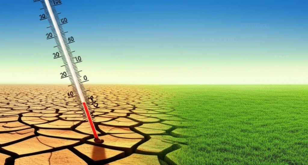
Surreal illustration of climate change impact in Ethiopia, contrasting drought and greenery.

Decoding Climate Change: What's Happening in Ethiopia's Gilgel Abbay?

"A 30-Year Study Reveals Shifting Rainfall and Temperature Patterns in a Key Agricultural Region."


Climate change isn't just a global issue; it's a local one, too. How it manifests in specific regions dictates the future of communities, agriculture, and ecosystems. Understanding these localized shifts is key to adapting and mitigating the risks.

A recent study focused on the Gilgel Abbay catchment in Ethiopia, a vital cereal-producing area where farming relies heavily on consistent climate patterns. Researchers analyzed 30 years of rainfall and temperature data to identify any significant changes.

This article breaks down the study's findings, revealing the changing climate trends in Gilgel Abbay and exploring what these changes might mean for the region's future.

AI Search Multiple angles on this topic

Ethiopia's Climate Data Landscape

Ethiopia's Ministry of Planning and Development maintains an official climate-change knowledge portal containing data, policy documents, key performance indicators, resilience programs, and adaptation-and-mitigation research. The World Bank Climate Change Knowledge Portal provides an overview of Ethiopia's climate zones and seasonal temperature and precipitation patterns using the Köppen-Geiger classification, Climatic Research Unit data, and ECMWF Reanalysis v5 (ERA5). Its ERA5 climatology page covers the current climatological period of 1991–2020 and historical records dating to 1950. World Bank data resources also direct users to climate data and climate-risk information for understanding and communicating future climate-change scenarios.

Models, Projections, and Evaluation

Climate research in Ethiopia uses historical trend analysis, climate-model evaluation, scenario projections, and downscaling. A 2025 systematic review identified a lack of systematic evidence about where model evaluations have been conducted, which models and reference datasets were used, and how methodologies and performance metrics varied. High-resolution CMIP6 projections are presented as necessary for regional and local adaptation planning across different emission scenarios. Another study reports that combining downscaling with climate-change scenario analysis can clarify basin-level climatic diversity and regional variations.

A Century of Climate Evidence

Research on Ethiopia's climate history includes an examination of annual and seasonal rainfall and temperature variability from 1901 to 2020. That study analyzed maximum, minimum, and mean temperature alongside monthly rainfall data, emphasizing that climate change is not spatially or temporally uniform. A 2026 synthesis describes Ethiopia as highly vulnerable to climate variability and extremes, with fragmented evidence limiting a comprehensive understanding of long-term trends and impacts. The World Bank's country-specific resources identify major national milestones, including the 2021 Updated Nationally Determined Contribution, the 2019 Climate Resilient Green Economy National Adaptation Plan, and the 2015 Second National Communication.

The Ups and Downs: Rainfall Variability and Rising Temperatures

Surreal illustration of climate change impact in Ethiopia, contrasting drought and greenery.

The research reveals a concerning trend: declining and increasingly variable rainfall over the past 30 years. At the same time, temperatures in the region are on the rise. This combination presents significant challenges for agriculture, which depends on predictable rainfall patterns and moderate temperatures.

The study also found variations within the catchment area itself. Higher-altitude areas in the upper catchment receive more rainfall and experience lower temperatures compared to the middle and lower regions. Seasonal differences are also significant, with most rainfall occurring during the summer months (June-September) and higher temperatures recorded in April and May.

  • Declining Rainfall: The average annual rainfall for the catchment is 1553 mm, but variability is high, with a coefficient of variation of 16.2%.
  • Rising Temperatures: The average annual temperature increase is +0.03045°C per year.
  • Spatial Variation: Rainfall is highest in the upper catchment areas and decreases towards the north. Temperature follows an opposite trend.
  • Seasonal Shifts: Rainfall is concentrated in the June-September period, while temperatures peak in April-May.
These findings highlight the complex nature of climate change impacts. It's not just about overall trends; understanding the spatial and temporal variations is crucial for effective adaptation strategies.

Adapting to a Changing Climate: What Can Be Done?

The study underscores the urgent need for adaptation strategies in the Gilgel Abbay catchment. With declining rainfall and rising temperatures, farmers and policymakers must take action to mitigate the negative impacts on agriculture and water resources.

AI Search Multiple angles on this topic

Livelihoods, Mobility, and Resilience

A study of the Gilgel Abbay Catchment in the Upper Blue Nile, northwestern Ethiopia, assessed climate change over the previous 30 years. In Borana, southern Ethiopia, pastoralist communities rely heavily on natural resources, including livestock herding, while mobility has traditionally served as an adaptive strategy; the cited case study reports that climate change is reshaping these mobility patterns. An UNFCCC case study identifies frequent drought, occasional floods, seasonal shifts in rainfall and temperature, heatwaves, and storms among Ethiopia's climate-related challenges. Another UNFCCC case study describes a multifaceted response involving agroforestry, forest-sector development, and integrated water and soil-resource management.

The study suggests several potential adaptation measures:<ul><li><b>Adjusting Planting Schedules:</b> Altering planting dates to align with the changing rainfall patterns.</li><li><b>Diversifying Crops:</b> Introducing drought-resistant crop varieties to reduce vulnerability to rainfall shortages.</li><li><b>Improving Irrigation:</b> Implementing efficient irrigation systems to supplement rainfall and ensure water availability.</li><li><b>Promoting Agroforestry:</b> Integrating trees into agricultural systems to improve soil health and water retention.</li></ul>

By implementing these strategies, the Gilgel Abbay catchment can build resilience to climate change and ensure a sustainable future for its communities.

The catchment study at a glance

PopulationRainfall and temperature data from catchment stations[1]
SettingGilgel Abbay catchment, Ethiopia[1]
Durationthe last 30 years[1]
Main outcomeChanges and variability in rainfall and temperature[1]
Times cited1[1]

How the catchment findings fit wider basin evidence

A review describes a different seasonal pattern within the same watershed: precipitation decreased in winter and spring but increased significantly in summer during its study period. That contrast shows why an overall decline does not describe every season.[2]

A study in the Lake Tana sub-basin found annual precipitation decreasing across most of its area, while one station had a positive trend. The mixed station results echo the importance of local variation, but do not establish the same pattern at every Gilgel Abbay station.[2]

Basin-wide rainfall spans a broad range, with lower amounts near the Ethiopia-Sudan border and higher amounts in the upper basin and Dedessa sub-basin. These geographic contrasts are context, not a before-and-after comparison with the catchment study.[3]

What the observed patterns can-and cannot-tell us

The study’s station-based records and analysis of annual and decadal averages make its findings a description of observed catchment patterns over time, rather than a projection of future conditions.[1]

The reported long-term direction combines less rainfall with greater variability and rising temperature. It does not mean rainfall moved uniformly across seasons or places; the study also reports spatial and temporal variation.[1]

Higher, upper-catchment areas were cooler and wetter than middle and lower areas. Topography is a plausible source of such local differences in the basin, but the cited review does not test that mechanism specifically in this catchment.[1] [2]

About this Article -

Written with AI assistance from published research, and reviewed by the Mystum team. See our About page for more information.

This article is based on research published under:

DOI-LINK: 10.4314/ejesm.v6i6.7, Alternate LINK

Title: Climate Change In Gilgel Abbay Catchment Upper Blue Nile, Northwestern Ethiopia

Subject: General Medicine

Journal: Ethiopian Journal of Environmental Studies and Management

Publisher: African Journals Online (AJOL)

Authors: Master Minale

Published: 2013-11-08

Everything You Need To Know

1

Is climate change happening in the Gilgel Abbay catchment?

The research indicates that the Gilgel Abbay catchment is experiencing climate change. This is demonstrated by declining and increasingly variable rainfall alongside rising temperatures over a 30-year period. These changes are significant because they directly impact agriculture, which relies on predictable climate patterns.

2

What are the main findings of the climate study in the Gilgel Abbay catchment?

The key findings include declining rainfall, rising temperatures, spatial variations in rainfall and temperature across the catchment, and seasonal shifts in rainfall and temperature patterns. The average annual rainfall is 1553 mm, but variability is high, with a coefficient of variation of 16.2%. Temperatures are increasing at an average of +0.03045°C per year. Rainfall is highest in the upper catchment and decreases towards the north, with temperature following an opposite trend. Rainfall is concentrated in June-September and temperatures peak in April-May. These findings highlight the complex nature of climate change impacts and are crucial for developing effective adaptation strategies.

3

What does 'spatial variation' mean in the context of the Gilgel Abbay catchment study?

Spatial variation refers to the differences in climate patterns across different parts of the Gilgel Abbay catchment. The upper catchment areas receive more rainfall and experience lower temperatures, while the middle and lower regions have less rainfall and higher temperatures. This variation is important because it means that the impact of climate change isn't uniform. Adaptation strategies must consider these local differences to be effective, as different areas will require tailored approaches.

4

What are the implications of climate change for agriculture in the Gilgel Abbay catchment?

The rising temperatures and declining, variable rainfall present significant challenges for agriculture in the Gilgel Abbay catchment. Farmers depend on consistent climate patterns for crop production. The changing climate threatens this consistency, potentially leading to reduced crop yields, increased water stress, and altered growing seasons. Without adaptation, these changes could have dire consequences for food security and the livelihoods of those dependent on farming.

5

What steps can be taken to adapt to the changing climate in the Gilgel Abbay catchment?

Effective adaptation strategies are essential to mitigate the negative impacts of climate change in the Gilgel Abbay catchment. These strategies must address declining rainfall and rising temperatures. This could involve implementing water conservation techniques, promoting drought-resistant crops, adjusting planting schedules, and developing more resilient farming practices. Policymakers also have a role in providing support, such as investing in climate-resilient infrastructure and providing farmers with the resources and information they need to adapt.

Newsletter Subscribe

Subscribe to get the latest articles and insights directly in your inbox.