
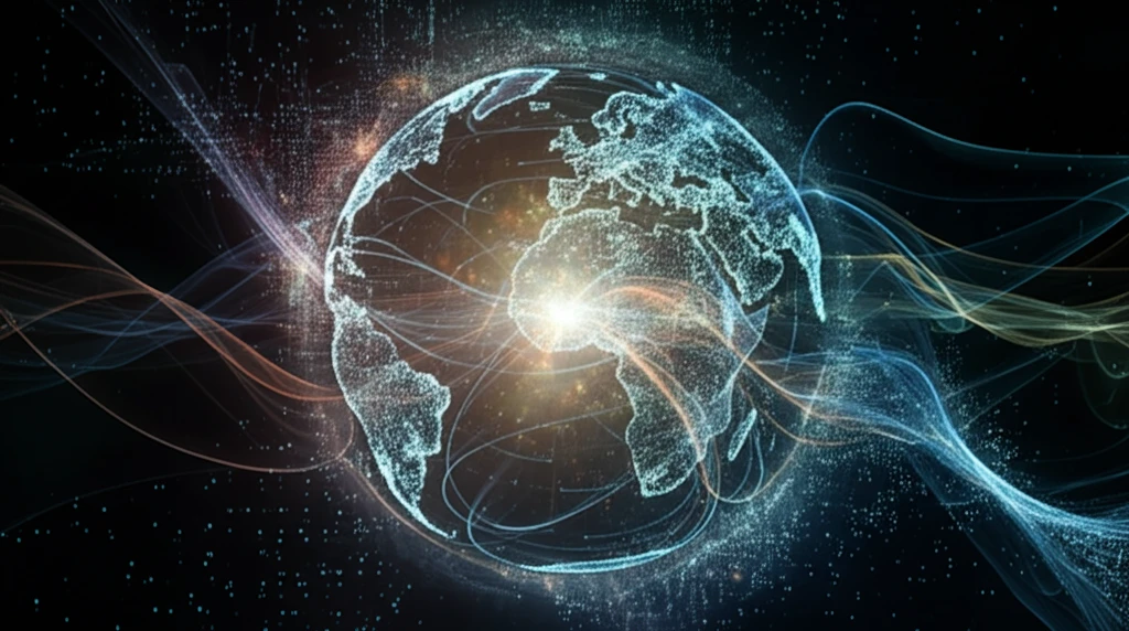
Riding the Winds of Change: How Big Data is Revolutionizing Ocean Wind Analysis

"Discover how NoSQL databases and advanced data mining techniques are transforming our understanding of sea surface winds, offering unprecedented insights for environmental monitoring and climate science."
Global wind data has become an indispensable resource across numerous fields, providing an unprecedented view of ocean surface winds. The availability of this data at large spatial scales and high temporal resolutions is transforming environmental science, biology, meteorology, and climate studies. Researchers and practitioners alike are leveraging these datasets to gain deeper insights into weather patterns, climate change, and oceanic phenomena.
The increasing adoption of NoSQL databases in big data applications is a game-changer. Their inherent simplicity and flexibility in data model design, combined with effective data recovery mechanisms, robust system availability, and horizontal scalability, make them ideally suited for handling the complexities of heterogeneous data sources. By integrating diverse datasets into a unified repository, NoSQL databases enable the selection and recovery of geospatial wind data from specific regions of interest.
The primary objective is to harness the power of data mining applications to analyze this wealth of information and visualize the results, thus gaining a more profound understanding of wind patterns and their impact on our planet. This interdisciplinary approach is paving the way for innovative solutions to some of the most pressing environmental challenges.
The Scale of Geospatial Observation
Geospatial Big Data refers to large, complex datasets tied to geographic locations, collected from diverse sources such as satellite imagery, remote sensing, sensors, and mobile devices — the same observation streams that track wind conditions over open ocean. Advances in data collection and storage have made these datasets increasingly practical to work with, though their sheer size keeps processing itself a benchmark challenge. Big raster data, for example, allows researchers to integrate diverse measurements and uncover new knowledge about geospatial patterns and processes, with platforms routinely evaluated on operations such as pixel count, reclassification, raster add, focal averaging, and zonal statistics across multiple datasets. Point-of-interest records add another layer of granular detail, with one Indonesian study compiling 17,542 public-access points in East Java Province alone.
Blending Remote Sensing with Big Data — and Its Limits
Conventional analysis leans heavily on remote sensing (RS) imagery, with emerging Geospatial Big Data positioned as a supplement that extends understanding from physical aspects such as urban land cover to socioeconomic aspects such as urban land use. A common technique is multisource data fusion, demonstrated using open geospatial big data to demarcate an urban agglomeration footprint along Sri Lanka's Southern Coastal Belt. Yet both broad methodologies carry well-documented weaknesses: knowledge-based approaches are criticized for scalability and transferability problems, while data-driven approaches are faulted for lacking interpretability and depending heavily on data quality. Practitioners underscore that location context is what gives data analytical value, since "data without location is like a drone without propellers."
From Cartography to a New Way of Thinking
Big Data has been described as one of the most remarkable intellectual and technological shifts of the modern era — not merely an enormous quantity of information but a completely new way of thinking about knowledge itself. In the geospatial domain the challenge is longstanding: data arrive in various types and formats, new geospatial data are acquired very quickly, and geospatial databases are inherently very large. Early momentum came from tying location to pressing real-world questions, such as cartography's renewed visibility during the blockage of the Strait of Hormuz, and from applications like poverty mapping, where machine-learning models trained on Nigeria's 2018 Demographic and Health Survey were cross-checked and validated against the 2018/19 Nigeria Living Standards Survey.
Harnessing NoSQL for Sea Wind Data Management
The volume, velocity, variety, veracity, and value—the five V's of big data—perfectly encapsulate the challenges and opportunities presented by global wind data. The sheer volume of data, sourced from various satellites such as QuikSCAT, RapidSCAT, ASCAT, and WindSat, requires robust storage solutions. The velocity at which this data is continuously analyzed demands real-time processing capabilities, crucial for applications like forest fire monitoring, hurricane tracking, and weather prediction.
- Simplified Data Models: Facilitates the integration of diverse data formats.
- High Scalability: Easily accommodates growing data volumes.
- Real-Time Processing: Enables rapid analysis for timely decision-making.
- Geospatial Capabilities: Supports the storage and analysis of location-based data.
Handling Theory as the Active Frontier
Recent peer-reviewed work situates big data squarely within the traditional disciplinary area of geospatial data handling theory and methods. A widely cited review by Suzana Dragicevic (ISPRS Journal of Photogrammetry and Remote Sensing, 2015) framed geospatial big data handling as a research challenge, and it has since been drawn on in work using heterogeneous geospatial big data to improve decision-making. More recent studies, such as 2023 research on geospatial big data analytics for sustainable smart cities, walk through Python-based collection, storage, management, exploration, processing, and analysis of massive geospatial datasets, together with the libraries, techniques, algorithms, and case studies involved. These reviews collectively point to handling theory — not just storage capacity — as the active frontier.
Isolation Is the Enemy of Value
Industry bodies argue that the economic value of geospatial data is rarely found in the data alone; it emerges only when information is connected across organizations, combined with other datasets, and applied to real-world decisions. Likewise, qualitative researchers caution that using Big Data in isolation can be problematic, and that quantitative results need "thick data" — deep qualitative context — to complement them. In practice, Geospatial Big Data is still treated as a supplement to remote sensing rather than a standalone source, helping explain urban lands from physical land cover to socioeconomic land use but inheriting the limitations of whatever data feed it.
Platforms, Fusion, and Trade-Offs
Researchers surveying the geospatial big data landscape have produced comparative studies of available frameworks, including an experimental evaluation of two of the most widely used platforms, GeoSpark and Spatial Hadoop. A recurring theme in these comparisons is that no single platform dominates, with the best choice hinging on the specific analytical task. Beyond platform selection, integrated approaches that fuse geospatial big data from multiple sources — including location-based services and remote sensing platforms, supplemented with traditional survey data — are recommended for studying both human and physical dimensions of a region. Commercial cloud offerings have moved in the same direction, with services like Google's Places Insights in BigQuery combining geospatial data with rich point-of-interest data to support analysis at scale.
The Horizon: Future Directions in Wind Data Analysis
The future of sea surface wind data analysis lies in enriching data fusion with additional satellite and social media data. Redesigning existing data mining algorithms to suit the unique characteristics of NoSQL systems and comparing the performance of different NoSQL database engines are essential steps. High-performance computing (HPC) and cloud computing (CC) will enable more efficient geodata access, thereby enhancing our ability to understand and respond to environmental changes.
It's the Where That Provides Context
Mansour Raad, a Big Data expert at Esri, frames location as the connective tissue of analytics, arguing that "everything that happens, happens somewhere — it's the where that provides context." From this vantage point, the geospatial big data problem is not simply about storing or processing more points but about solving spatial analytics at scale so that location context can inform decisions in near real time. For ocean wind analysis, this synthesis implies that the value of floating sensors, satellite scatterometers, and model outputs emerges only when their locations are unified and analyzed together.
The AI Perfect Storm
Commentators describe the convergence of artificial intelligence and geospatial big data as a "perfect storm," with advances in analysis techniques such as classification and prediction driving geographic information systems forward. High-performance computing is emerging as a core direction for handling these datasets, as demonstrated in work such as temperature-trend analysis of the Subansiri River basin under RCP scenarios using CMIP5 climate projections. Progress is not frictionless: spatial queries over big geospatial data remain complex and time-consuming, requiring intensive disk input/output access and spatial computation. The field continues to broaden its scope, with special issues framing Geospatial Big Data as any data and information stream carrying specific spatial and location references.
Access, Governance, and the Data Mesh Shift
Geospatial organizations face unique Big Data challenges in making location-specific intelligence accessible anytime, anywhere to their personnel and the public, according to GCS founder and president Alex Philp. Making that happen at scale strains governance and infrastructure alike, which is why ideas like the data mesh are gaining ground — a shift from treating data as an asset to treating it as a product, from proprietary big platforms to an ecosystem of self-serve data infrastructure built on open protocols, and from top-down manual data governance to federated computational governance. Underneath these debates is a basic caveat: geospatial big data reflects the historical activities of users, so analyses built on it describe past behavior and must be interpreted accordingly.
From Raw Data to Real Decisions
Geospatial big data comprises a large portion of all big data and is essential and powerful for decision-making when utilized strategically, yet its sheer volume and high dimensionality are major barriers to strategic use. Interactive, data-driven tools such as the open-source idwMapper aim to lower that barrier, letting analysts map and explore large datasets on the web rather than wrestling with them in isolation. On the applied side, rich geospatial data combined with causal machine learning is being used to map potential economic benefits from incremental investments across all major types of public and economic infrastructure in Africa — a concrete illustration of location intelligence translated into human-relevant outcomes.