Digital GIS map integrated with oil rig platform, symbolizing enhanced risk management.

Mapping the Future: How Digital Risk Management is Revolutionizing Oil & Gas

"Discover how GIS technology is transforming asset integrity and risk management in the oil and gas industry, creating safer and more efficient operations."


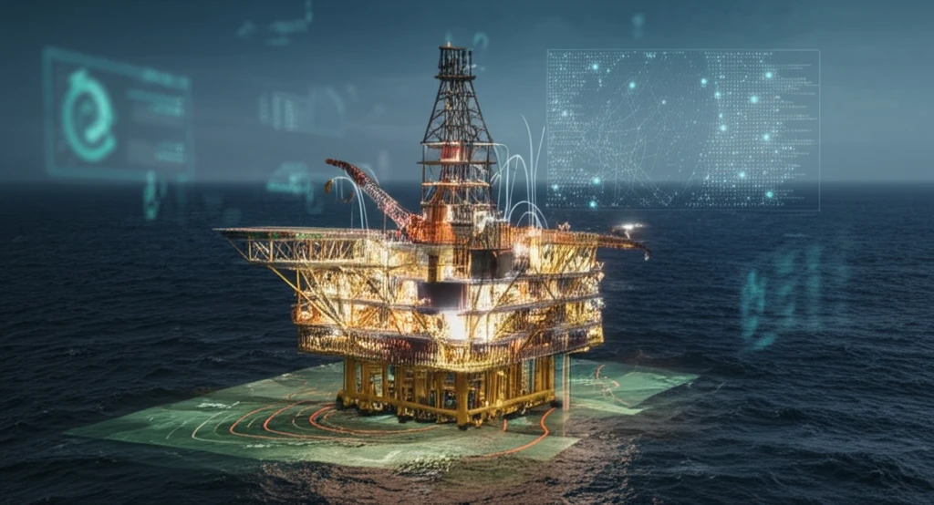
In the dynamic world of oil and gas, managing risk and maintaining asset integrity are paramount. Aging infrastructure, complex operations, and stringent safety regulations demand innovative solutions. Enter the Geographic Information System (GIS)—a powerful tool transforming how the industry visualizes, analyzes, and manages risk.

Traditionally, oil and gas companies have relied on disparate data sources and manual processes to assess risk. This approach is often time-consuming, inefficient, and prone to errors. However, with the advent of digital technologies, GIS offers a consolidated and visual platform for risk management, enabling better decision-making and improved operational outcomes.

This article explores how Geographic Information Systems (GIS) is helping to revolutionize asset integrity in the oil and gas sector, creating safer and more efficient operations by integrating digital solutions for enhanced risk management, visualization, and real-time decision-making.

Why Digital Risk Mapping is Essential for Modern Oil & Gas Operations?

Digital GIS map integrated with oil rig platform, symbolizing enhanced risk management.

The integration of GIS into risk management offers a multitude of benefits. By centralizing data and providing a visual representation of assets and potential hazards, GIS empowers oil and gas companies to:

GIS helps in improving efficiency and safety through:

  • Enhance Risk Visualization: GIS mapping allows for the clear visualization of potential risks, such as leaks, equipment failures, and environmental hazards, across the entire infrastructure.
  • Improve Data Integration: By consolidating data from various sources—including inspection reports, sensor data, and maintenance logs—GIS provides a holistic view of asset health.
  • Enable Proactive Decision-Making: Real-time data and predictive analytics enable proactive maintenance and risk mitigation strategies, reducing the likelihood of costly incidents.
  • Streamline Emergency Response: GIS mapping facilitates rapid and effective emergency response by providing critical information about asset locations, potential hazards, and evacuation routes.
Moreover, GIS implementation addresses critical industry needs. Consider Abu Al Bukhoosh (ABK), an oil and gas field operating since 1974. With aging platforms and facilities, ABK exemplifies the challenges of maintaining asset integrity. GIS offers a solution by providing continuous monitoring, rigorous planning, and a comprehensive approach to managing operational risks, thereby ensuring long-term profitability and HSE (Health, Safety, and Environment) performance.

The Future of Risk Management: Embracing Digital Transformation

As the oil and gas industry continues to evolve, the adoption of digital risk management strategies is no longer a luxury but a necessity. By embracing GIS and other innovative technologies, companies can enhance safety, improve efficiency, and ensure long-term sustainability. The journey towards digital transformation promises a future where risk is not just managed but proactively mitigated, paving the way for a safer and more prosperous industry.

About this Article -

This article was crafted using a human-AI hybrid and collaborative approach. AI assisted our team with initial drafting, research insights, identifying key questions, and image generation. Our human editors guided topic selection, defined the angle, structured the content, ensured factual accuracy and relevance, refined the tone, and conducted thorough editing to deliver helpful, high-quality information.See our About page for more information.

Everything You Need To Know

1

What is Geographic Information System (GIS) and how is it used in the oil and gas industry?

Geographic Information System (GIS) is a digital tool utilized in the oil and gas sector for visualizing, analyzing, and managing risk. It offers a consolidated and visual platform, replacing the traditionally disparate data sources and manual processes. GIS integrates data from various sources like inspection reports, sensor data, and maintenance logs to provide a holistic view of asset health. Its application helps in enhancing risk visualization, improving data integration, enabling proactive decision-making, and streamlining emergency response. GIS is essential for managing the complex operations, aging infrastructure, and stringent safety regulations within the oil and gas industry.

2

How does GIS improve asset integrity in oil and gas operations?

GIS significantly improves asset integrity in oil and gas operations by providing a comprehensive approach to risk management. It allows for the clear visualization of potential risks such as leaks and equipment failures across the infrastructure. Furthermore, it improves data integration by consolidating data from diverse sources. This enables proactive decision-making through real-time data and predictive analytics, reducing the likelihood of costly incidents. Companies like Abu Al Bukhoosh (ABK), which operates with aging facilities, benefit from GIS through continuous monitoring, rigorous planning, and a comprehensive approach to managing operational risks, thereby ensuring long-term profitability and HSE performance.

3

What are the key benefits of using digital risk mapping in oil and gas operations?

The key benefits of using digital risk mapping in oil and gas operations include enhanced risk visualization, improved data integration, the ability to enable proactive decision-making, and the streamlining of emergency responses. GIS mapping visualizes potential risks, such as leaks and equipment failures. It consolidates data from various sources to provide a holistic view of asset health, helping in the timely detection and management of issues. Real-time data and predictive analytics enable proactive maintenance, and risk mitigation strategies reducing the likelihood of costly incidents. Moreover, GIS mapping provides critical information about asset locations, potential hazards, and evacuation routes, facilitating rapid and effective emergency response.

4

How does GIS help streamline emergency response in the oil and gas sector?

GIS streamlines emergency response by providing critical information about asset locations, potential hazards, and evacuation routes. Through GIS mapping, emergency responders gain rapid access to essential data. This includes the location of assets, the nature of potential hazards (such as leaks or fires), and pre-planned evacuation routes. With this information, emergency teams can make informed decisions quickly, coordinate effectively, and minimize the impact of incidents, ensuring the safety of personnel and the environment. For example, in the case of a platform leak, GIS can pinpoint the exact location, assess the spread of the hazard, and direct evacuation routes to prevent exposure.

5

Can you explain the role of GIS in ensuring the long-term sustainability and profitability of oil and gas companies?

GIS plays a crucial role in ensuring the long-term sustainability and profitability of oil and gas companies by enhancing safety, improving operational efficiency, and enabling proactive risk management. By providing enhanced risk visualization and enabling proactive decision-making, GIS helps in reducing the frequency and severity of incidents, thereby minimizing costs associated with repairs, environmental cleanup, and regulatory penalties. The ability to integrate and analyze vast amounts of data allows for optimized maintenance schedules and resource allocation, leading to greater operational efficiency. By ensuring long-term profitability and HSE performance through rigorous planning and continuous monitoring, GIS supports a safer and more prosperous industry. The case of Abu Al Bukhoosh (ABK) demonstrates how GIS ensures operational risks are managed, leading to sustainable and profitable operations even with aging infrastructure.

Newsletter Subscribe

Subscribe to get the latest articles and insights directly in your inbox.