Wireless sensor network for landslide monitoring.

Landslide Alert: How Wireless Sensor Networks Can Save Lives

"Early warning systems powered by cutting-edge tech offer a lifeline for communities at risk."


Imagine living in a place where the ground beneath your feet could give way at any moment. Landslides are a terrifying reality for many communities around the world, causing billions in damages and countless lives lost each year. Traditional monitoring methods often fall short, struggling with accuracy, cost, and the ability to provide timely warnings. But what if there was a way to get ahead of these disasters, to know when the earth is about to move and give people time to escape?

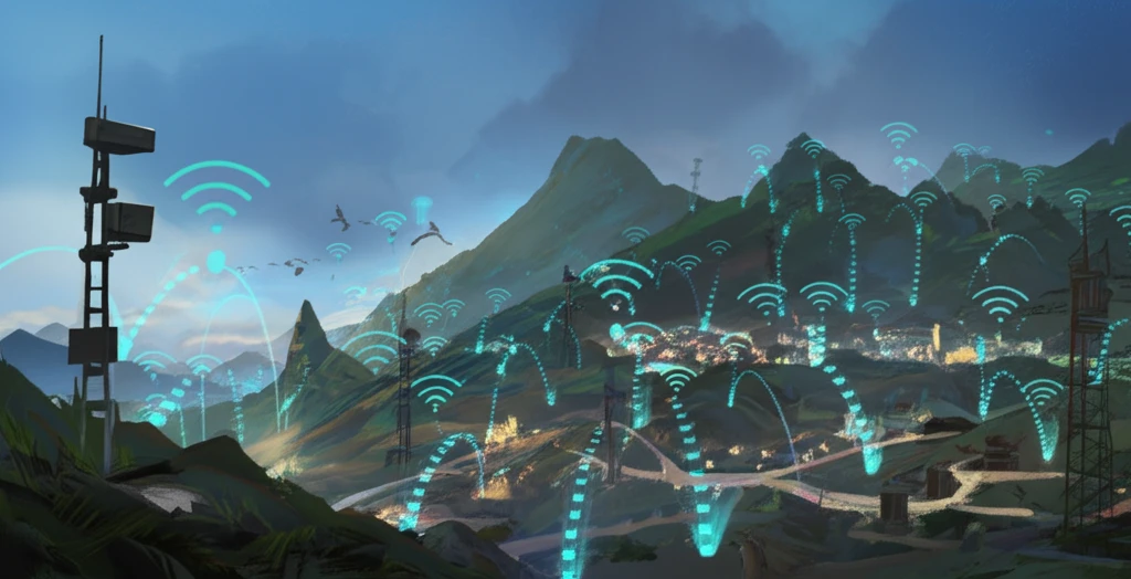
That's the promise of wireless sensor networks (WSNs), a cutting-edge technology that's transforming the field of landslide monitoring. These networks use a series of tiny, low-power sensors to collect real-time data on everything from soil moisture and temperature to ground movement and vibration. This information is then transmitted wirelessly to a central monitoring station, where it can be analyzed to detect potential landslide triggers and issue early warnings.

This article will explore how WSNs work, what their benefits are, and how they're being used to protect communities around the world. You'll discover how this technology is overcoming the limitations of traditional methods, providing more accurate, timely, and cost-effective landslide monitoring. It is not just about technology, it is a tool that empowers communities, providing a sense of security and control in the face of a natural hazard.

How Wireless Sensor Networks are Changing the Game

Wireless sensor network for landslide monitoring.

Traditional landslide monitoring techniques often rely on visual inspections, GPS measurements, and other manual methods. These approaches can be time-consuming, expensive, and limited in their ability to provide real-time data. Close-range photogrammetry, for example, can be affected by weather conditions, while GPS monitoring can be too costly for large-scale implementation. Moreover, satellite signals can be easily blocked in wild and high-altitude environments.

Wireless sensor networks offer a number of advantages over these traditional methods:

  • Real-time Data Acquisition: WSNs provide continuous, real-time data on a variety of environmental factors, allowing for early detection of potential landslide triggers.
  • Remote Transmission and Query: Data can be transmitted wirelessly to a central monitoring station, where it can be accessed and analyzed remotely.
  • Improved Accuracy: By collecting data from multiple sensors, WSNs can provide a more comprehensive and accurate picture of ground conditions than traditional methods.
  • Cost-Effectiveness: WSNs can be more cost-effective than traditional methods, especially for large-scale monitoring projects.
  • Flexibility: WSNs can be deployed in a variety of environments, including remote and difficult-to-access areas.
The core of a WSN-based landslide monitoring system consists of several key components: the sensors themselves, which are strategically placed throughout the area of interest; a data acquisition system, which collects and processes the sensor data; a communication network, which transmits the data to a central monitoring station; and a data analysis and visualization system, which allows experts to interpret the data and issue warnings.

The Future of Landslide Monitoring

Wireless sensor networks are not a silver bullet for landslide monitoring, but they represent a significant step forward in our ability to protect communities at risk. As the technology continues to evolve, we can expect to see even more innovative applications of WSNs for landslide monitoring and other environmental hazards. By embracing these advancements, we can create a safer, more resilient world for everyone.

About this Article -

This article was crafted using a human-AI hybrid and collaborative approach. AI assisted our team with initial drafting, research insights, identifying key questions, and image generation. Our human editors guided topic selection, defined the angle, structured the content, ensured factual accuracy and relevance, refined the tone, and conducted thorough editing to deliver helpful, high-quality information.See our About page for more information.

Everything You Need To Know

1

What makes Wireless Sensor Networks (WSNs) a game-changer in monitoring landslides compared to older methods?

Wireless Sensor Networks (WSNs) represent a significant advancement because they provide real-time data acquisition, remote transmission capabilities, improved accuracy through multiple sensors, cost-effectiveness, and deployment flexibility. Unlike traditional methods that rely on visual inspections or infrequent GPS measurements, WSNs continuously monitor environmental factors, enabling early detection of potential landslide triggers, even in remote and difficult-to-access areas. This overcomes limitations such as weather dependency and high costs associated with methods like close-range photogrammetry and large-scale GPS monitoring.

2

How do Wireless Sensor Networks (WSNs) actually work to monitor landslides, and what components are involved?

Wireless Sensor Networks (WSNs) function through strategically placed sensors that collect real-time data on soil moisture, temperature, ground movement, and vibration. This data is then acquired and processed by a data acquisition system before being transmitted wirelessly to a central monitoring station via a communication network. The collected data is analyzed and visualized, allowing experts to interpret the information and issue timely warnings. Missing in this description is the type of communication protocols being used and the type of sensor used to measure movement, such as tiltmeters or extensometers.

3

What are the tangible benefits of using Wireless Sensor Networks (WSNs) for landslide monitoring in terms of community safety and cost?

Wireless Sensor Networks (WSNs) enhance community safety by providing early warnings, enabling timely evacuations and reducing the risk of casualties. They offer cost-effectiveness compared to traditional methods, especially for large-scale monitoring projects, because of their lower maintenance and operational costs. While providing a sense of security and control by empowering communities, the absence of detailed cost-benefit analysis on different types of geographic location and its effects on the ROI are unknown.

4

Are Wireless Sensor Networks (WSNs) a perfect solution for landslide monitoring, and what future developments can we expect in this field?

Wireless Sensor Networks (WSNs) are not a perfect solution, but a significant step forward. The technology is continuously evolving, with expected innovations leading to more advanced applications for landslide monitoring and other environmental hazards. The next generation of WSNs can provide enhanced features and integration with other technologies. However, to fully realize the potential, the system needs to deal with the limitations such as sensor battery life and data security.

5

How do the limitations of traditional landslide monitoring methods, such as GPS and close-range photogrammetry, highlight the value of Wireless Sensor Networks (WSNs)?

Traditional landslide monitoring methods like GPS measurements and close-range photogrammetry can be time-consuming, expensive, and limited in providing real-time data. Close-range photogrammetry is affected by weather conditions, GPS monitoring is costly for large-scale implementation, and satellite signals can be blocked in remote areas. Wireless Sensor Networks (WSNs) address these limitations by offering continuous, real-time data acquisition, remote transmission, and cost-effectiveness, making them more practical and efficient for comprehensive landslide monitoring.

Newsletter Subscribe

Subscribe to get the latest articles and insights directly in your inbox.